TL;DR / Executive Summary
- Portugal has expanded its ICEYE SAR satellite fleet to strengthen defence, maritime monitoring and environmental response [1]
- ICEYE and Liberty have introduced a wildfire insurance solution using satellite data for rapid damage assessment and payouts [2]
[1] ICEYE, the European leader in sovereign intelligence from space, today announced that CTI Aeroespacial, a joint venture between the Portuguese Air Force and CEiiA, has signed a contract to procure two additional synthetic aperture radar (SAR) satellite systems to be operated by the Portuguese Air Force (Força Aérea Portuguesa, FAP).
This brings the total number of ICEYE-built satellites available to the Portuguese Air Force to four. Portugal’s first sovereign SAR satellite was launched in March 2026 and is already supporting national operations. The new satellites have been inspected by Portuguese Air Force personnel at ICEYE’s production facility in Finland, confirming readiness ahead of delivery.
With four satellites, FAP can task and collect data faster, evolving its sovereign space assets into a high-speed constellation for the Atlantic maritime domain and Exclusive Economic Zone (EEZ). Portugal’s SAR capacity also serves civil applications such as environmental monitoring and disaster response.
“Those who see clearly act faster and Portugal is building the sovereign capability to do exactly that,” said Jordi Laguarda, VP Missions, Spain and Portugal at ICEYE. “This expanded constellation gives FAP the revisit rates and response times that modern defence and civil protection missions demand. Space-based intelligence, operational at the speed of real-world events.”
Chief of Staff of the Portuguese Air Force, General Sérgio da Costa Pereira, said: “This latest acquisition strengthens Portugal’s freedom of action. The expanded SAR capability improves readiness for defense and security missions while supporting wider national ambitions, including environmental monitoring and the safeguarding of natural resources.”
Europe cannot defend what it cannot see. Across Europe, space-based intelligence has moved from long-term strategic investment to operational necessity and the window to act is now. Backed by a recent Series F funding round, ICEYE is accelerating to meet that demand: delivering complete end-to-end sovereign intelligence systems to seven European nations, including Portugal, and beyond.
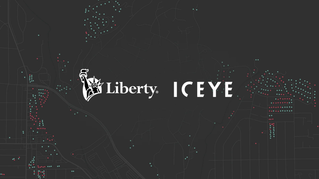
[2] Liberty and ICEYE, the world leader in sovereign intelligence from space, today announced the launch of a pioneering building-level parametric wildfire insurance solution.
As wildfires increase in frequency and severity, impacting communities and driving significant economic losses, the need for faster, more responsive risk solutions has never been greater. Liberty’s remotely sensed parametric property wildfire solution enables a rapid response providing immediate access to liquidity when it is needed most. The solution is initially available in the US and Australia, where wildfire exposure is particularly high, but targeted to expand together with ICEYE’s product scope expansion.
At the core of the solution is ICEYE’s global constellation of Synthetic Aperture Radar (SAR) satellites, which provides continuous monitoring of wildfire-affected areas. These satellites capture high-resolution imagery through smoke, at night, and in all weather conditions, ensuring reliable and uninterrupted data collection.
Following a wildfire event, SAR imagery is combined with detailed property footprint data and advanced automated machine learning algorithms to deliver an objective, building-level damage assessment. Each insured property is classified against predefined criteria as either “destroyed” or “undamaged,” with results that could be delivered within hours.
This transparent, binary approach eliminates the need for site visits, loss adjusters, or subjective assessments. Instead, it enables fast and consistent evaluations at the individual property level, triggering payout procedures within days when agreed parameters are met.
Leveraging this technology, Liberty’s parametric wildfire cover offers scalable protection that complements traditional insurance. This solution is designed for a wide range of clients, including homeowner associations, residential communities, municipalities and public risk pools, as well as owners of critical infrastructure and (re)insurers with residential and commercial property portfolios seeking to reduce their wildfire exposure.
Jean-Christophe Garaix, Head of Parametrics & Agriculture at Liberty, said: “By pushing the boundaries of technology, we are delivering a new generation of parametric wildfire coverage that is faster, more responsive, and fully data driven. Our property wildfire cover is remotely sensed and designed to address the growing threat of wildfires, providing reliable protection alongside traditional insurance that allows for more efficient claims settlement.”
Anke Sielker, Head of Reinsurance Solutions at ICEYE, added: “We are delighted to be working with Liberty on this ground-breaking solution. Built on rapid and verifiable observation data from our SAR satellite constellation, this offering provides quick confirmation when agreed loss parameters are met. The result is fast, precise, and consistent damage assessments at the individual property level, and can be deployed in high-risk areas to support multi-asset portfolios or regional programs.”